
Thank you for supporting this site ❤️
Make a donation
Make a donation
Gear up for your next adventure:
As an Amazon Associate, this site earns from qualifying purchases at no extra cost to you.
Lloseta topographic map
Click on the map to display elevation.
Thank you for supporting this site ❤️
Make a donation
Make a donation
Gear up for your next adventure:
As an Amazon Associate, this site earns from qualifying purchases at no extra cost to you.
About this map
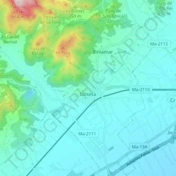
Name: Lloseta topographic map, elevation, terrain.
Location: Lloseta, Raiguer, Balearische Inseln, 07360, Spanien (39.69361 2.82452 39.74649 2.88905)
Average elevation: 191 m
Minimum elevation: 101 m
Maximum elevation: 654 m
Thank you for supporting this site ❤️
Make a donation
Make a donation
Gear up for your next adventure:
As an Amazon Associate, this site earns from qualifying purchases at no extra cost to you.