Geolocate

Deghat topographic map

Click on the map to display elevation.

About this map

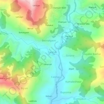
Name: Deghat topographic map, elevation, terrain.

Location: Deghat, Syalde, Almora District, Uttarakhand, 263659, India (29.88059 79.20323 29.92059 79.24323)

Average elevation: 1,127 m

Minimum elevation: 928 m

Maximum elevation: 1,549 m

Gear up for your next adventure:

🥾Durable Hiking Shoes - Long-lasting shoes for frequent hiking
🔦LED Flashlight - Powerful and long-lasting flashlight for camping and emergencies
🛏️Camping Sleeping Mat - Comfortable mats for sleeping outdoors
🧥Fleece Jacket - Warm and lightweight jacket for layering
🧢Beanie Hat - Keep your head warm in cold weather

As an Amazon Associate, this site earns from qualifying purchases at no extra cost to you.