Geolocate

Jones topographic map

Click on the map to display elevation.

About this map

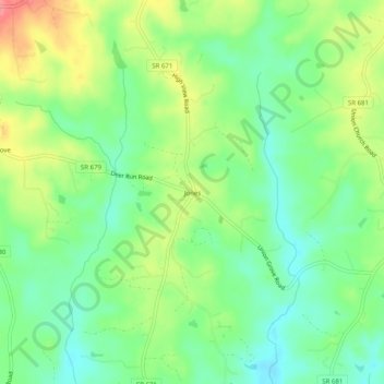
Name: Jones topographic map, elevation, terrain.

Location: Jones, Halifax County, Virginia, United States (36.70903 -79.05001 36.74903 -79.01001)

Average elevation: 149 m

Minimum elevation: 118 m

Maximum elevation: 198 m

Other topographic maps

Click on a map to view its topography, its elevation and its terrain.

Conner Lake

United States > Virginia > Halifax County

Average elevation: 130 m

Gear up for your next adventure:

🧦Outdoor Socks - Durable socks designed for hiking and outdoor sports
🚲Heavy Duty Bike Lock - Secure your bike at the trailhead or during stops
🧥Thermal Fleece Jacket - Versatile insulation for changing mountain temperatures
Family Camping Tent - Spacious tent suitable for family camping trips
🛶Kayak Dry Bag - Waterproof storage for kayaking adventures

As an Amazon Associate, this site earns from qualifying purchases at no extra cost to you.