
Thank you for supporting this site ❤️
Make a donation
Make a donation
Gear up for your next adventure:
As an Amazon Associate, this site earns from qualifying purchases at no extra cost to you.
Pedorido topographic map
Click on the map to display elevation.
Thank you for supporting this site ❤️
Make a donation
Make a donation
Gear up for your next adventure:
As an Amazon Associate, this site earns from qualifying purchases at no extra cost to you.
About this map
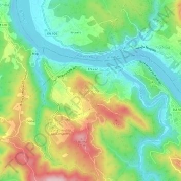
Name: Pedorido topographic map, elevation, terrain.
Location: Pedorido, Castelo de Paiva, Aveiro, 4515-289, Portugal (41.02273 -8.40509 41.06273 -8.36509)
Average elevation: 110 m
Minimum elevation: 5 m
Maximum elevation: 288 m
Thank you for supporting this site ❤️
Make a donation
Make a donation
Gear up for your next adventure:
As an Amazon Associate, this site earns from qualifying purchases at no extra cost to you.