Geolocate

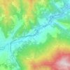
Iggio topographic map

Click on the map to display elevation.

About this map

Name: Iggio topographic map, elevation, terrain.

Location: Iggio, Pellegrino Parmense, Parma, Emilia-Romagna, Italia (44.72363 9.85431 44.76363 9.89431)

Average elevation: 528 m

Minimum elevation: 307 m

Maximum elevation: 878 m

Other topographic maps

Click on a map to view its topography, its elevation and its terrain.

Varano de' Melegari

Italia > Emilia-Romagna > Parma

Average elevation: 363 m

Pellegrino Parmense

Italia > Emilia-Romagna > Parma

Average elevation: 432 m

Compiano

Italia > Emilia-Romagna > Parma

Average elevation: 758 m

Fiume Taro

Italia > Emilia-Romagna > Parma > Copezzato

Average elevation: 35 m

Busseto

Italia > Emilia-Romagna > Parma

Average elevation: 47 m

Torrente Baganza

Italia > Emilia-Romagna > Parma > Parma

Average elevation: 114 m

Colorno

Italia > Emilia-Romagna > Parma

Average elevation: 29 m

Soragna

Italia > Emilia-Romagna > Parma

Average elevation: 42 m

Taro

Italia > Emilia-Romagna > Parma > Borgo Val di Taro

Average elevation: 699 m

Gear up for your next adventure:

🎒Fully Waterproof Backpack - Total protection for photography gear and electronics
🔥Camping Stove - Portable stoves to cook outdoors with ease
🥾Approach Boots - Comfortable boots for hiking and climbing approaches
🧥Ultralight Puffy Jacket - Maximum warmth that packs down to the size of an orange
🧥Packable Rain Jacket - Breathable waterproof layer for unpredictable weather

As an Amazon Associate, this site earns from qualifying purchases at no extra cost to you.