
Pantnagar topographic map
Click on the map to display elevation.
Pantnagar
The Campus appears impressive today with its well-tended fields, a network of roads, housing colonies, street lighting, a telephone exchange, hospitals, marketing centres, a water supply section, a community radio station 90.8 MHz, canteens, 6 primary schools and 3 secondary schools. The main campus lies in Udham Singh Nagar district of Uttarakhand at 29° N latitude and 79° E longitude at an elevation of 243.8 m above the mean sea level. This main campus has the area responsibility for the entire Uttarakhand representing plains, Tarai, Bhabar and hill areas. However, to provide service to the hill region its other stations are situated at Ranichauri (Tehri district), Majhera (Nainital district) and at Lohaghat-Sui (Champawat district). There are 763 teachers and officers 59 technical staff, 631 administrative and ministerial personnel and 1425 class III employees, amounting to a total strength of 2878. The number of students in the University ranges between 2800 and 3000. Thus, the teacher taught ratio is about 1:6 and student-staff ratio is about 1:1.
About this map
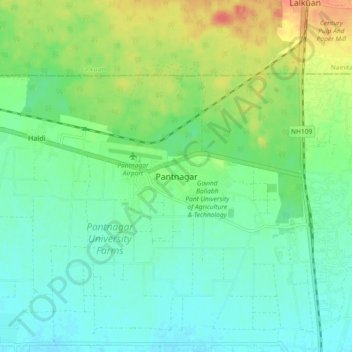
Name: Pantnagar topographic map, elevation, terrain.
Average elevation: 233 m
Minimum elevation: 217 m
Maximum elevation: 268 m
Other topographic maps
Click on a map to view its topography, its elevation and its terrain.