
Thank you for supporting this site ❤️
Make a donation
Make a donation
Gear up for your next adventure:
As an Amazon Associate, this site earns from qualifying purchases at no extra cost to you.
Malija topographic map
Click on the map to display elevation.
Thank you for supporting this site ❤️
Make a donation
Make a donation
Gear up for your next adventure:
As an Amazon Associate, this site earns from qualifying purchases at no extra cost to you.
About this map
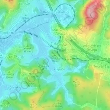
Name: Malija topographic map, elevation, terrain.
Location: Malija, Grosuplje, Upravna Enota Grosuplje, 1293, Slovenia (45.97822 14.59505 45.97832 14.59515)
Average elevation: 340 m
Minimum elevation: 292 m
Maximum elevation: 462 m
Thank you for supporting this site ❤️
Make a donation
Make a donation
Gear up for your next adventure:
As an Amazon Associate, this site earns from qualifying purchases at no extra cost to you.