
Thank you for supporting this site ❤️
Make a donation
Make a donation
Gear up for your next adventure:
As an Amazon Associate, this site earns from qualifying purchases at no extra cost to you.
Gravin topographic map
Click on the map to display elevation.
Thank you for supporting this site ❤️
Make a donation
Make a donation
Gear up for your next adventure:
As an Amazon Associate, this site earns from qualifying purchases at no extra cost to you.
About this map
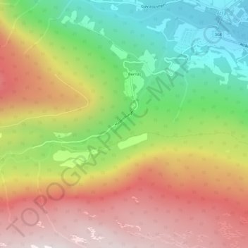
Name: Gravin topographic map, elevation, terrain.
Location: Gravin, Lindemyr, Atrå, Tinn, Vestfold og Telemark, Noorwegen (59.96586 8.70303 59.98586 8.72303)
Average elevation: 581 m
Minimum elevation: 217 m
Maximum elevation: 950 m
Thank you for supporting this site ❤️
Make a donation
Make a donation
Gear up for your next adventure:
As an Amazon Associate, this site earns from qualifying purchases at no extra cost to you.