
Thank you for supporting this site ❤️
Make a donation
Make a donation
Gear up for your next adventure:
As an Amazon Associate, this site earns from qualifying purchases at no extra cost to you.
Şehzadeler topographic map
Click on the map to display elevation.
Thank you for supporting this site ❤️
Make a donation
Make a donation
Gear up for your next adventure:
As an Amazon Associate, this site earns from qualifying purchases at no extra cost to you.
About this map
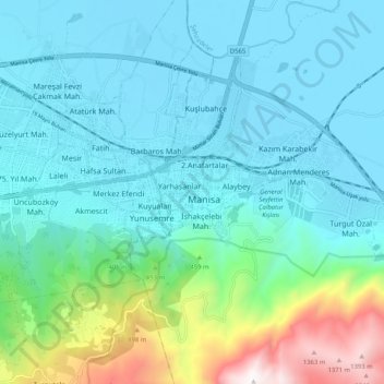
Name: Şehzadeler topographic map, elevation, terrain.
Location: Şehzadeler, Manisa, Aegean Region, 45020, Turkey (38.57402 27.39030 38.65402 27.47030)
Average elevation: 296 m
Minimum elevation: 24 m
Maximum elevation: 1,477 m
Thank you for supporting this site ❤️
Make a donation
Make a donation
Gear up for your next adventure:
As an Amazon Associate, this site earns from qualifying purchases at no extra cost to you.