Geolocate

Garbsen topographic map

Click on the map to display elevation.

Garbsen

Garbsen belongs to the Weser-Aller-Flachland natural area and is situated between the lowlands of the river Leine and the Otternhagener Moor. The differences in altitude are only a few meters.

Wikipedia (CC-BY-SA 3.0)

About this map

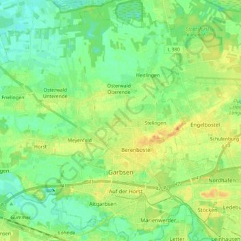
Name: Garbsen topographic map, elevation, terrain.

Location: Garbsen, Region Hannover, Lower Saxony, Germany (52.39796 9.48433 52.50122 9.64538)

Average elevation: 50 m

Minimum elevation: 39 m

Maximum elevation: 64 m

Gear up for your next adventure:

🌬️Windproof Camp Stove - Efficient cooking even on exposed mountain peaks
🥫Freeze-Dried Meals - Lightweight, high-calorie nutrition for multi-day treks
🛌Insulated Sleeping Pad - Critical thermal barrier between you and the cold ground
🥾Trail Running Shoes - Lightweight and durable shoes for trail running
🕯️Camping Lantern - Illuminates your entire campsite with high-efficiency LEDs

As an Amazon Associate, this site earns from qualifying purchases at no extra cost to you.