Geolocate

Purodi topographic map

Click on the map to display elevation.

About this map

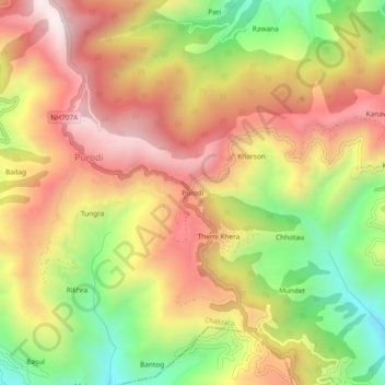
Name: Purodi topographic map, elevation, terrain.

Location: Purodi, Chakrata, Dehradun, Uttarakhand, 248196, India (30.64191 77.87601 30.68191 77.91601)

Average elevation: 1,806 m

Minimum elevation: 1,363 m

Maximum elevation: 2,188 m

Gear up for your next adventure:

🗺️Topographic Maps - Detailed maps to explore trails, mountains, and wilderness areas
🧢Outdoor Visor - Breathable visor for sunny hikes
🥾Waterproof Trail Shoes - Shoes designed to handle wet terrain
🚲Handlebar Phone Mount - View topographic-map.com live while cycling
🥾Trekking Boots - Durable boots for long-distance trekking

As an Amazon Associate, this site earns from qualifying purchases at no extra cost to you.