Geolocate

La Tortuga topographic map

Click on the map to display elevation.

About this map

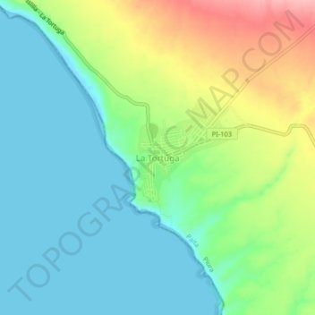
Name: La Tortuga topographic map, elevation, terrain.

Location: La Tortuga, Paita, Piura, Perú (-5.30044 -81.14274 -5.26044 -81.10274)

Average elevation: 41 m

Minimum elevation: -1 m

Maximum elevation: 131 m

Other topographic maps

Click on a map to view its topography, its elevation and its terrain.

Plaza de Armas de Paita

Perú > Piura > Paita

Average elevation: 33 m

Gear up for your next adventure:

🛰️Satellite Messenger - Emergency communication for areas with no cell service
👟Trail Running Shoes - Agile footwear for fast-paced topographic exploration
🧥Waterproof Pants - Keep dry during rainy hiking conditions
🥾Hiking Shorts - Breathable shorts suitable for summer hikes
Camping Coffee Maker - Brew fresh coffee anywhere on the topographic map

As an Amazon Associate, this site earns from qualifying purchases at no extra cost to you.