Geolocate

Algoma topographic map

Click on the map to display elevation.

About this map

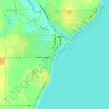
Name: Algoma topographic map, elevation, terrain.

Location: Algoma, Kewaunee County, Wisconsin, United States (44.58830 -87.46476 44.61983 -87.41809)

Average elevation: 182 m

Minimum elevation: 171 m

Maximum elevation: 203 m

Other topographic maps

Click on a map to view its topography, its elevation and its terrain.

Rosiere

United States > Wisconsin > Kewaunee County

Average elevation: 245 m

Gear up for your next adventure:

🥤Collapsible Travel Cup - Saves space and weight in your mess kit
🧦Merino Wool Socks - Moisture-wicking comfort for long-distance hiking
🧢Hiking Hat - Sun-protective and breathable hats for long treks
🛌Down Sleeping Bag - Superior warmth-to-weight ratio for cold nights
💧Collapsible Water Bottle - Space-saving water bottle for outdoor activities

As an Amazon Associate, this site earns from qualifying purchases at no extra cost to you.