Geolocate

Azamnagar topographic map

Click on the map to display elevation.

About this map

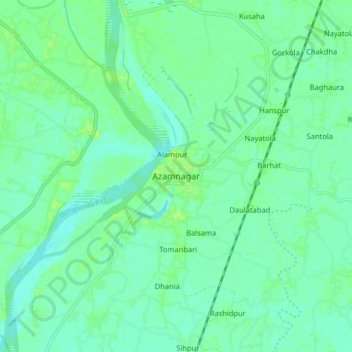
Name: Azamnagar topographic map, elevation, terrain.

Location: Azamnagar, Katihar, Bihar, 855102, India (25.50734 87.78838 25.58734 87.86838)

Average elevation: 31 m

Minimum elevation: 25 m

Maximum elevation: 40 m

Gear up for your next adventure:

🔦UV Flashlight - Detect minerals or specific insects in the dark
🏕️Camping Hammock - Integrated protection for sleeping between trees
💡Portable Camping Lamp - Rechargeable lamp for campsite lighting
🔋Lithium AA Batteries - Long-lasting power that performs in extreme cold
🧢Sun Hat - Wide-brim hat for sun protection

As an Amazon Associate, this site earns from qualifying purchases at no extra cost to you.