Geolocate

Murud topographic map

Click on the map to display elevation.

About this map

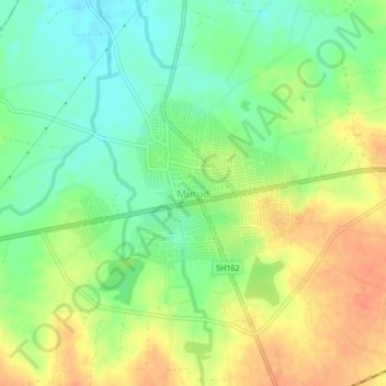
Name: Murud topographic map, elevation, terrain.

Location: Murud, Latur, Latur District, Maharashtra, 413510, India (18.38328 76.22082 18.42328 76.26082)

Average elevation: 678 m

Minimum elevation: 655 m

Maximum elevation: 703 m

Gear up for your next adventure:

🦶Hiking Shoe Insoles - Added support for high arches and long days on feet
🧰Emergency Multi-Tool - Compact multi-tool for outdoor survival
🧼Biodegradable Camp Soap - Environmentally friendly cleaning for gear and body
🧦Merino Wool Socks - Moisture-wicking comfort for long-distance hiking
🔨Vehicle Emergency Tool - Safety tool for remote road trips to trailheads

As an Amazon Associate, this site earns from qualifying purchases at no extra cost to you.