
Runnymede topographic map
Interactive map
Click on the map to display elevation.
About this map
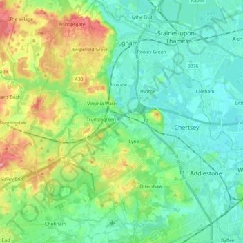
Name: Runnymede topographic map, elevation, terrain.
Location: Runnymede, Surrey, South East, Angleterre, Royaume-Uni (51.33886 -0.61965 51.45101 -0.45791)
Average elevation: 34 m
Minimum elevation: 8 m
Maximum elevation: 99 m