Geolocate

Merpas topographic map

Click on the map to display elevation.

About this map

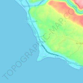
Name: Merpas topographic map, elevation, terrain.

Location: Merpas, Kaur, Bengkulu, Sumatra, 38564, Indonesia (-4.92694 103.51485 -4.88694 103.55485)

Average elevation: 24 m

Minimum elevation: 0 m

Maximum elevation: 134 m

Gear up for your next adventure:

🧤Insulated Winter Gloves - Heavy-duty protection for sub-zero Canadian adventures
💡Compact LED Flashlight - Powerful and portable flashlight for outdoor use
🔭Compact Monocular - One-handed bird watching and trail spotting
Backpacking Tent - Lightweight tent for long-distance hiking trips
🔦UV Flashlight - Detect minerals or specific insects in the dark

As an Amazon Associate, this site earns from qualifying purchases at no extra cost to you.