Geolocate

Hanapepe topographic map

Click on the map to display elevation.

About this map

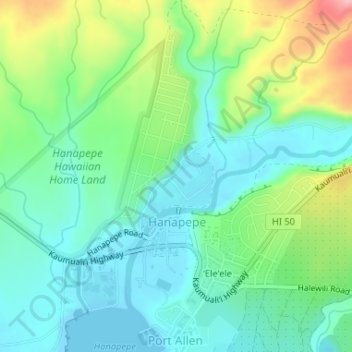
Name: Hanapepe topographic map, elevation, terrain.

Location: Hanapepe, Kauaʻi County, Hawaii, 46716, United States (21.90010 -159.59772 21.93043 -159.56938)

Average elevation: 44 m

Minimum elevation: 0 m

Maximum elevation: 149 m

Gear up for your next adventure:

🧰Survival Kit - Essential gear for emergencies in the wilderness
🥾Mountain Hiking Shoes - Shoes with superior grip for mountainous terrain
🧥Ultralight Puffy Jacket - Maximum warmth that packs down to the size of an orange
👟Sport Hiking Sandals - Breathable footwear for water crossings and camp rest
🧴First Aid Kit - Essential first aid supplies for outdoor emergencies

As an Amazon Associate, this site earns from qualifying purchases at no extra cost to you.