Geolocate

Decaturville topographic map

Click on the map to display elevation.

About this map

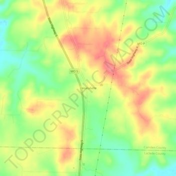
Name: Decaturville topographic map, elevation, terrain.

Location: Decaturville, Camden County, Missouri, 65537, United States (37.88754 -92.71990 37.92754 -92.67990)

Average elevation: 317 m

Minimum elevation: 276 m

Maximum elevation: 355 m

Gear up for your next adventure:

🦶Hiking Shoe Insoles - Added support for high arches and long days on feet
👟Sport Hiking Sandals - Breathable footwear for water crossings and camp rest
👟Trail Running Shoes - Agile footwear for fast-paced topographic exploration
🧥Softshell Hiking Jacket - The perfect balance of wind protection and breathability
🧥Ultralight Puffy Jacket - Maximum warmth that packs down to the size of an orange

As an Amazon Associate, this site earns from qualifying purchases at no extra cost to you.