
Thank you for supporting this site ❤️
Make a donation
Make a donation
Gear up for your next adventure:
As an Amazon Associate, this site earns from qualifying purchases at no extra cost to you.
Inamgaon topographic map
Click on the map to display elevation.
Thank you for supporting this site ❤️
Make a donation
Make a donation
Gear up for your next adventure:
As an Amazon Associate, this site earns from qualifying purchases at no extra cost to you.
About this map
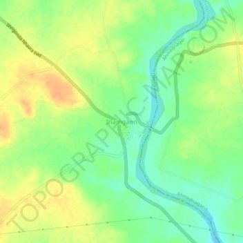
Name: Inamgaon topographic map, elevation, terrain.
Location: Inamgaon, Shirur, Pune District, Maharashtra, 414701, India (18.57003 74.51771 18.61003 74.55771)
Average elevation: 526 m
Minimum elevation: 508 m
Maximum elevation: 543 m
Thank you for supporting this site ❤️
Make a donation
Make a donation
Gear up for your next adventure:
As an Amazon Associate, this site earns from qualifying purchases at no extra cost to you.