Geolocate

Maiolati Spontini topographic map

Click on the map to display elevation.

About this map
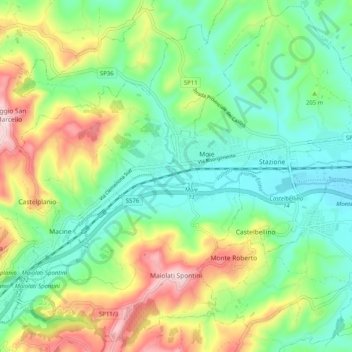
Name: Maiolati Spontini topographic map, elevation, terrain.

Location: Maiolati Spontini, Ancona, Marche, 60030, Italy (43.46297 13.07423 43.53387 13.17537)

Average elevation: 195 m

Minimum elevation: 81 m

Maximum elevation: 419 m

Gear up for your next adventure:

🚑Survival Whistle - Signal for help across long distances in mountains
🛰️Satellite Messenger - Emergency communication for areas with no cell service
🥽Outdoor Goggles - Protective eyewear for outdoor activities
🛌Insulated Sleeping Pad - Critical thermal barrier between you and the cold ground
🛶Kayak Dry Bag - Waterproof storage for kayaking adventures

As an Amazon Associate, this site earns from qualifying purchases at no extra cost to you.