Geolocate

Las-ud topographic map

Click on the map to display elevation.

About this map

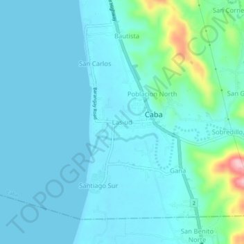
Name: Las-ud topographic map, elevation, terrain.

Location: Las-ud, Caba, La Union, Ilocos Region, 2502, Philippines (16.41057 120.32022 16.45057 120.36022)

Average elevation: 24 m

Minimum elevation: 0 m

Maximum elevation: 177 m

Gear up for your next adventure:

🧶550 Survival Paracord - Versatile utility cord for emergency repairs and rigging
🥾Light Trekking Boots - Supportive boots for multi-day treks
🗺️Topographic Maps - Detailed maps to explore trails, mountains, and wilderness areas
💡Compact LED Flashlight - Powerful and portable flashlight for outdoor use
🥾Trail Running Shoes - Lightweight and durable shoes for trail running

As an Amazon Associate, this site earns from qualifying purchases at no extra cost to you.