
Thank you for supporting this site ❤️
Make a donation
Make a donation
Gear up for your next adventure:
As an Amazon Associate, this site earns from qualifying purchases at no extra cost to you.
Bernister topographic map
Click on the map to display elevation.
Thank you for supporting this site ❤️
Make a donation
Make a donation
Gear up for your next adventure:
As an Amazon Associate, this site earns from qualifying purchases at no extra cost to you.
About this map
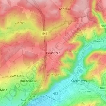
Name: Bernister topographic map, elevation, terrain.
Location: Bernister, Malmedy, Verviers, Liège, Wallonia, 4960, Belgium (50.41704 5.99227 50.45704 6.03227)
Average elevation: 437 m
Minimum elevation: 318 m
Maximum elevation: 536 m
Thank you for supporting this site ❤️
Make a donation
Make a donation
Gear up for your next adventure:
As an Amazon Associate, this site earns from qualifying purchases at no extra cost to you.