Geolocate

Pakadi topographic map

Click on the map to display elevation.

About this map

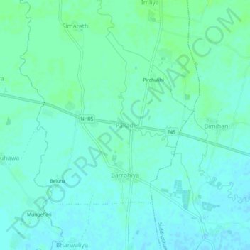
Name: Pakadi topographic map, elevation, terrain.

Location: Pakadi, Mayadevi, Kapilvastu, Lumbini Province, Nepal (27.50438 83.13118 27.54438 83.17118)

Average elevation: 102 m

Minimum elevation: 98 m

Maximum elevation: 106 m

Other topographic maps

Click on a map to view its topography, its elevation and its terrain.

Maharajgunj

Nepal > Lumbini Province > Kapilvastu

Average elevation: 102 m

Buddhabhumi

Nepal > Lumbini Province > Kapilvastu

Average elevation: 246 m

Kapilbastu

Nepal > Lumbini Province > Kapilvastu

Average elevation: 105 m

Kapilbastu

Nepal > Lumbini Province > Kapilvastu

Average elevation: 105 m

Gear up for your next adventure:

🥾Waterproof Trail Shoes - Shoes designed to handle wet terrain
🧴Bear Spray Holster - Quick-access carry for essential Canadian wilderness safety
🔭Outdoor Binoculars - Lightweight binoculars for birdwatching and hiking
🥾Mountain Trail Shoes - High-traction shoes for mountain trails
Lightweight Backpacking Tent - Compact tent for efficient hiking trips

As an Amazon Associate, this site earns from qualifying purchases at no extra cost to you.