
Bois-de-Haye topographic map
Interactive map
Click on the map to display elevation.
About this map
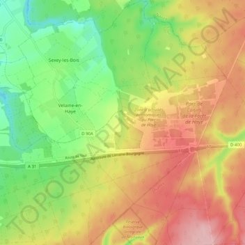
Name: Bois-de-Haye topographic map, elevation, terrain.
Average elevation: 292 m
Minimum elevation: 214 m
Maximum elevation: 373 m
Other topographic maps
Click on a map to view its topography, its elevation and its terrain.
Sexey-les-Bois
France > Grand Est > Meurthe-et-Moselle > Bois-de-Haye
Sexey-les-Bois, Bois-de-Haye, Toul, Meurthe-et-Moselle, Grand Est, France métropolitaine, 54840, France
Average elevation: 260 m