Geolocate

Clyde topographic map

Click on the map to display elevation.

About this map

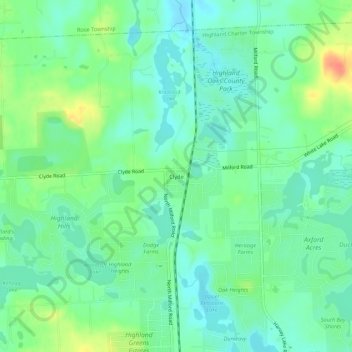
Name: Clyde topographic map, elevation, terrain.

Location: Clyde, Highland Charter Township, Oakland County, Michigan, 48357, United States (42.66086 -83.63800 42.70086 -83.59800)

Average elevation: 315 m

Minimum elevation: 299 m

Maximum elevation: 348 m

Other topographic maps

Click on a map to view its topography, its elevation and its terrain.

Gear up for your next adventure:

🛶Waterproof Dry Bags - Keep electronics and clothes dry during river crossings
🧥Packable Rain Jacket - Breathable waterproof layer for unpredictable weather
🧊Insulated Water Bottle - Keeps drinks cold in summer and prevents freezing in winter
🧦Thermal Socks - Warm socks for winter hiking or camping
🪑Insulated Seat Pad - Protect your seat from cold rocks and wet logs

As an Amazon Associate, this site earns from qualifying purchases at no extra cost to you.