Geolocate

Bray topographic map

Click on the map to display elevation.

About this map

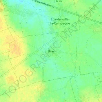
Name: Bray topographic map, elevation, terrain.

Location: Bray, Bernay, Eure, Normandy, Metropolitan France, 27170, France (49.08663 0.82147 49.12663 0.86147)

Average elevation: 151 m

Minimum elevation: 139 m

Maximum elevation: 163 m

Gear up for your next adventure:

🥾Lightweight Hiking Shoes - Comfortable shoes for day hikes
🧢Beanie Hat - Keep your head warm in cold weather
🛶Canoe Life Vest - Safety vest for water sports
📷Outdoor Action Camera - Capture high-elevation views and rugged adventures
🧢Hiking Hat - Sun-protective and breathable hats for long treks

As an Amazon Associate, this site earns from qualifying purchases at no extra cost to you.