
Thank you for supporting this site ❤️
Make a donation
Make a donation
Gear up for your next adventure:
As an Amazon Associate, this site earns from qualifying purchases at no extra cost to you.
Jhuni topographic map
Click on the map to display elevation.
Thank you for supporting this site ❤️
Make a donation
Make a donation
Gear up for your next adventure:
As an Amazon Associate, this site earns from qualifying purchases at no extra cost to you.
About this map
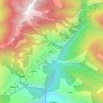
Name: Jhuni topographic map, elevation, terrain.
Location: Jhuni, Kapkot, Bageshwar, Uttarakhand, India (30.09131 79.96969 30.13131 80.00969)
Average elevation: 2,589 m
Minimum elevation: 1,868 m
Maximum elevation: 3,448 m
Thank you for supporting this site ❤️
Make a donation
Make a donation
Gear up for your next adventure:
As an Amazon Associate, this site earns from qualifying purchases at no extra cost to you.