
Thank you for supporting this site ❤️
Make a donation
Make a donation
Gear up for your next adventure:
As an Amazon Associate, this site earns from qualifying purchases at no extra cost to you.
Kapoli topographic map
Click on the map to display elevation.
Thank you for supporting this site ❤️
Make a donation
Make a donation
Gear up for your next adventure:
As an Amazon Associate, this site earns from qualifying purchases at no extra cost to you.
About this map
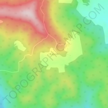
Name: Kapoli topographic map, elevation, terrain.
Location: Kapoli, Khanapura taluku, Belagavi, Karnataka, India (15.64087 74.34955 15.68087 74.38955)
Average elevation: 810 m
Minimum elevation: 652 m
Maximum elevation: 1,009 m
Thank you for supporting this site ❤️
Make a donation
Make a donation
Gear up for your next adventure:
As an Amazon Associate, this site earns from qualifying purchases at no extra cost to you.