
Thank you for supporting this site ❤️
Make a donation
Make a donation
Gear up for your next adventure:
As an Amazon Associate, this site earns from qualifying purchases at no extra cost to you.
Gomariz topographic map
Click on the map to display elevation.
Thank you for supporting this site ❤️
Make a donation
Make a donation
Gear up for your next adventure:
As an Amazon Associate, this site earns from qualifying purchases at no extra cost to you.
About this map
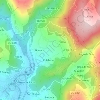
Name: Gomariz topographic map, elevation, terrain.
Location: Gomariz, Leiro, O Ribeiro, Ourense, Galicien, 32429, Spanien (42.36942 -8.12248 42.38897 -8.09979)
Average elevation: 207 m
Minimum elevation: 83 m
Maximum elevation: 413 m
Thank you for supporting this site ❤️
Make a donation
Make a donation
Gear up for your next adventure:
As an Amazon Associate, this site earns from qualifying purchases at no extra cost to you.