
Thank you for supporting this site ❤️
Make a donation
Make a donation
Gear up for your next adventure:
As an Amazon Associate, this site earns from qualifying purchases at no extra cost to you.
Vielsalm topographic map
Click on the map to display elevation.
Thank you for supporting this site ❤️
Make a donation
Make a donation
Gear up for your next adventure:
As an Amazon Associate, this site earns from qualifying purchases at no extra cost to you.
About this map
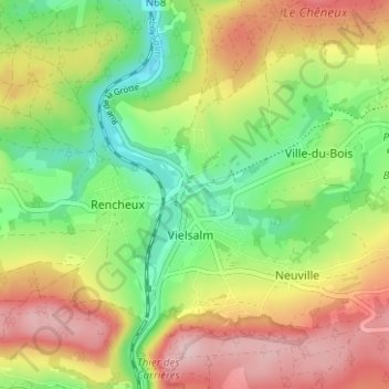
Name: Vielsalm topographic map, elevation, terrain.
Location: Vielsalm, Bastogne, Luxembourg, Wallonia, 6690, Belgium (50.26837 5.89702 50.30837 5.93702)
Average elevation: 423 m
Minimum elevation: 323 m
Maximum elevation: 542 m
Thank you for supporting this site ❤️
Make a donation
Make a donation
Gear up for your next adventure:
As an Amazon Associate, this site earns from qualifying purchases at no extra cost to you.