
Benguela topographic map
Interactive map
Click on the map to display elevation.
About this map
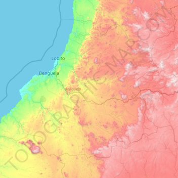
Name: Benguela topographic map, elevation, terrain.
Location: Benguela, Angola (-13.87445 12.31596 -11.75892 15.11083)
Average elevation: 886 m
Minimum elevation: 0 m
Maximum elevation: 2,541 m