

Make a donation
Gear up for your next adventure:
As an Amazon Associate, this site earns from qualifying purchases at no extra cost to you.
West Lafayette topographic map
Click on the map to display elevation.
Make a donation
Gear up for your next adventure:
As an Amazon Associate, this site earns from qualifying purchases at no extra cost to you.
West Lafayette
West Lafayette lies in central Tippecanoe County and overlooks the Wabash River, which borders the city on the east and south. Most of the city lies in eastern Wabash Township, though a small portion on the northeast side extends into Tippecanoe Township. Elevations range from slightly over 500 feet (150 m) near the river to more than 720 feet (220 m) in northern parts of the city near U.S. Route 52.
Make a donation
Gear up for your next adventure:
As an Amazon Associate, this site earns from qualifying purchases at no extra cost to you.
About this map
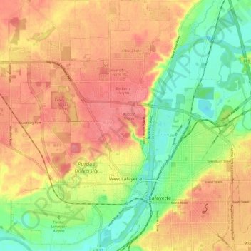
Name: West Lafayette topographic map, elevation, terrain.
Location: West Lafayette, Tippecanoe County, Indiana, United States (40.40002 -86.96244 40.48954 -86.88698)
Average elevation: 192 m
Minimum elevation: 150 m
Maximum elevation: 225 m
Make a donation
Gear up for your next adventure:
As an Amazon Associate, this site earns from qualifying purchases at no extra cost to you.