Geolocate

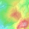
Grebenau topographic map

Click on the map to display elevation.

About this map

Name: Grebenau topographic map, elevation, terrain.

Location: Grebenau, Vogelsbergkreis, Hessen, 36323, Duitsland (50.69096 9.35326 50.76970 9.50739)

Average elevation: 363 m

Minimum elevation: 243 m

Maximum elevation: 494 m

Other topographic maps

Click on a map to view its topography, its elevation and its terrain.
Dick

Duitsland > Hessen > Vogelsbergkreis > Alsfeld

Average elevation: 378 m

Gear up for your next adventure:

🦶Hiking Shoe Insoles - Added support for high arches and long days on feet
🔦UV Flashlight - Detect minerals or specific insects in the dark
🔦LED Flashlight - Powerful and long-lasting flashlight for camping and emergencies
🥾Lightweight Hiking Shoes - Comfortable shoes for day hikes
🎒Hiking Backpack - Lightweight and ergonomic backpacks for day hikes or multi-day treks

As an Amazon Associate, this site earns from qualifying purchases at no extra cost to you.