Geolocate

Nipa topographic map

Click on the map to display elevation.

About this map

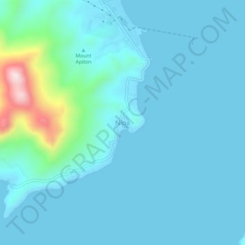
Name: Nipa topographic map, elevation, terrain.

Location: Nipa, Concepcion, Iloilo, Western Visayas, 5013, Philippines (11.15148 123.10318 11.19148 123.14318)

Average elevation: 48 m

Minimum elevation: -1 m

Maximum elevation: 419 m

Other topographic maps

Click on a map to view its topography, its elevation and its terrain.

Magais Island

Philippines > Iloilo > Concepcion > Talotu-an

Average elevation: 2 m

Chico Island

Philippines > Iloilo > Concepcion > Malangabang

Average elevation: 6 m

Gear up for your next adventure:

🧊Portable Cooler - Keep food and drinks cold during outdoor adventures
🚲Bike Repair Kit - Essential tools for on-trail mechanical issues
🧭Orienteering Kit - Tools for map reading and navigation in the wild
🛌Down Sleeping Bag - Superior warmth-to-weight ratio for cold nights
Camping Coffee Maker - Brew fresh coffee anywhere on the topographic map

As an Amazon Associate, this site earns from qualifying purchases at no extra cost to you.