Geolocate

Indian River Falls topographic map

Click on the map to display elevation.

About this map

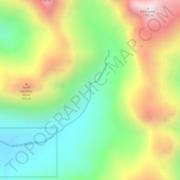
Name: Indian River Falls topographic map, elevation, terrain.

Location: Indian River Falls, Sitka, Alaska, United States (57.08845 -135.23678 57.08855 -135.23668)

Average elevation: 540 m

Minimum elevation: 109 m

Maximum elevation: 1,158 m

Gear up for your next adventure:

🍽️Titanium Camping Spork - Ultralight and indestructible eating utensil
🏕️Camping Hammock - Integrated protection for sleeping between trees
🔋Emergency Crank Radio - Weather alerts and power without needing batteries
🗺️Topographic Maps - Detailed maps to explore trails, mountains, and wilderness areas
💡Solar Camping Lamp - Eco-friendly lighting for campsites

As an Amazon Associate, this site earns from qualifying purchases at no extra cost to you.