Geolocate

Ranguas topographic map

Click on the map to display elevation.

About this map

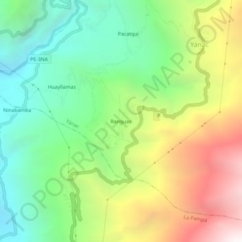
Name: Ranguas topographic map, elevation, terrain.

Location: Ranguas, Yánac, Corongo, Áncash, Perú (-8.65147 -77.89763 -8.61147 -77.85763)

Average elevation: 2,610 m

Minimum elevation: 1,637 m

Maximum elevation: 4,153 m

Gear up for your next adventure:

🥾Mountain Hiking Shoes - Shoes with superior grip for mountainous terrain
🧦Outdoor Socks - Durable socks designed for hiking and outdoor sports
💡Solar Camping Lamp - Eco-friendly lighting for campsites
🥾Trail Hiking Socks - Comfortable socks to prevent blisters and fatigue
🧥Thermal Fleece Jacket - Versatile insulation for changing mountain temperatures

As an Amazon Associate, this site earns from qualifying purchases at no extra cost to you.