Geolocate

Kapkembu topographic map

Click on the map to display elevation.

About this map

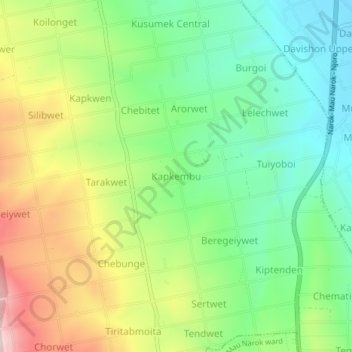
Name: Kapkembu topographic map, elevation, terrain.

Location: Kapkembu, Mauche ward, Njoro, Nakuru, Kenya (-0.50404 35.94098 -0.46404 35.98098)

Average elevation: 2,441 m

Minimum elevation: 2,287 m

Maximum elevation: 2,687 m

Gear up for your next adventure:

🧰Multitool Knife - Compact and versatile tool for outdoor use
🥾Hiking Leggings - Comfortable leggings for outdoor activities
🧰Survival Kit - Essential gear for emergencies in the wilderness
🥾Trekking Poles - Adjustable trekking poles to reduce knee stress and improve stability
🥾Waterproof Hiking Shoes - Durable shoes for wet and rugged trails

As an Amazon Associate, this site earns from qualifying purchases at no extra cost to you.