Geolocate

Saint Mary topographic map

Click on the map to display elevation.

About this map

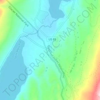
Name: Saint Mary topographic map, elevation, terrain.

Location: Saint Mary, Glacier County, Montana, United States (48.72387 -113.44955 48.76387 -113.40955)

Average elevation: 1,430 m

Minimum elevation: 1,361 m

Maximum elevation: 1,696 m

Other topographic maps

Click on a map to view its topography, its elevation and its terrain.

Grinnell Glacier

United States > Montana > Glacier County

Average elevation: 2,133 m

Blackfoot Glacier

United States > Montana > Glacier County

Average elevation: 2,316 m

Hidden Lake

United States > Montana > Glacier County

Average elevation: 1,416 m

Gem Glacier

United States > Montana > Glacier County

Average elevation: 2,150 m

Logan Glacier

United States > Montana > Glacier County

Average elevation: 2,232 m

Jackson Glacier

United States > Montana > Glacier County

Average elevation: 2,268 m

Iceberg Lake

United States > Montana > Glacier County

Average elevation: 2,163 m

Hope Lake

United States > Montana > Glacier County

Average elevation: 1,179 m

Lake Josephine

United States > Montana > Glacier County

Average elevation: 1,716 m

Lake Josephine

United States > Montana > Glacier County

Average elevation: 1,716 m

Browning

United States > Montana > Glacier County

Average elevation: 1,338 m

Logan Glacier

United States > Montana > Glacier County

Average elevation: 2,232 m

Pray Lake

United States > Montana > Glacier County

Average elevation: 1,717 m

Gear up for your next adventure:

🛌Down Sleeping Bag - Superior warmth-to-weight ratio for cold nights
👖Convertible Hiking Pants - Zip-off legs to adapt to changing weather conditions
🗺️Topographic Maps - Detailed maps to explore trails, mountains, and wilderness areas
🧤Rechargeable Heated Gloves - Extreme warmth for Canadian winter expeditions
🧴Sunscreen SPF - Broad-spectrum sunscreen for outdoor activities

As an Amazon Associate, this site earns from qualifying purchases at no extra cost to you.