
Thank you for supporting this site ❤️
Make a donation
Make a donation
Gear up for your next adventure:
As an Amazon Associate, this site earns from qualifying purchases at no extra cost to you.
Molinello topographic map
Click on the map to display elevation.
Thank you for supporting this site ❤️
Make a donation
Make a donation
Gear up for your next adventure:
As an Amazon Associate, this site earns from qualifying purchases at no extra cost to you.
About this map
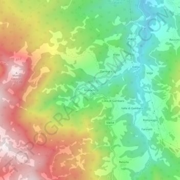
Name: Molinello topographic map, elevation, terrain.
Location: Molinello, Ferriere, Piacenza, Emilia-Romagna, 29024, Italia (44.59069 9.45706 44.63069 9.49706)
Average elevation: 1,045 m
Minimum elevation: 670 m
Maximum elevation: 1,546 m
Thank you for supporting this site ❤️
Make a donation
Make a donation
Gear up for your next adventure:
As an Amazon Associate, this site earns from qualifying purchases at no extra cost to you.