Geolocate

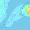
Zambales topographic map

Click on the map to display elevation.

About this map

Name: Zambales topographic map, elevation, terrain.

Location: Zambales, Zamboanga City, Zamboanga Peninsula, 7000, Philippines (7.01948 122.00944 7.05948 122.04944)

Average elevation: 772 m

Minimum elevation: 323 m

Maximum elevation: 1,194 m

Other topographic maps

Click on a map to view its topography, its elevation and its terrain.

Sacol Island

Philippines > Zamboanga City

Average elevation: 6 m

Vitali River

Philippines > Zamboanga City > Mangusu

Average elevation: 27 m

Sinunug Island

Philippines > Zamboanga City

Average elevation: 0 m

Plaza Pershing

Philippines > Zamboanga City

Average elevation: 4 m

Gear up for your next adventure:

🚲Heavy Duty Bike Lock - Secure your bike at the trailhead or during stops
🔋Solar Power Bank - Keep your GPS and devices charged during long outdoor trips
👟Sport Hiking Sandals - Breathable footwear for water crossings and camp rest
🛌Insulated Sleeping Pad - Critical thermal barrier between you and the cold ground
🥾Waterproof Hiking Boots - Boots keeping your feet dry in wet conditions

As an Amazon Associate, this site earns from qualifying purchases at no extra cost to you.