

Richmond topographic map
Click on the map to display elevation.
Richmond
The town centre lies just below 33 ft (10m) above sea level. South of the town centre, rising from Richmond Bridge to an elevation of 165 ft (50m), is Richmond Hill. Just beyond the summit of Richmond Hill is Richmond Park, an area of 2,360 acres (9.55 km2; 3.7 sq mi) of wild heath and woodland originally enclosed for hunting, and now forming London's largest royal park. The park is a national nature reserve, a Site of Special Scientific Interest and a Special Area of Conservation and is included, at Grade I, on Historic England's Register of Historic Parks and Gardens of special historic interest in England. It was created by Charles I in 1634 as a deer park and now has 630 red and fallow deer that roam freely through much of the park. The park has a number of traffic and pedestrian gates leading to the surrounding areas of Sheen, Roehampton, Putney, Kingston and Ham.
About this map
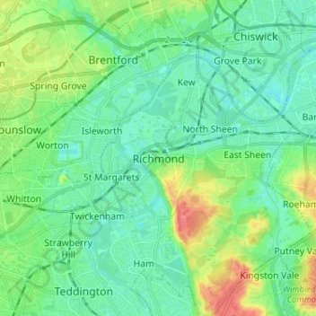
Name: Richmond topographic map, elevation, terrain.
Average elevation: 17 m
Minimum elevation: 0 m
Maximum elevation: 63 m