Geolocate

Lake Como topographic map

Click on the map to display elevation.

About this map

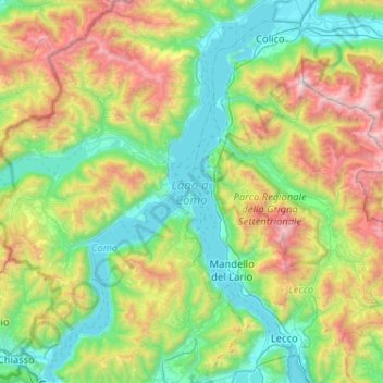
Name: Lake Como topographic map, elevation, terrain.

Location: Lake Como, Como, Lombardy, Italy (45.81316 9.06673 46.17036 9.38897)

Average elevation: 885 m

Minimum elevation: 188 m

Maximum elevation: 2,593 m

Gear up for your next adventure:

🛏️Sleeping Bag - Warm and compact sleeping bags for outdoor camping
🧥Softshell Jacket - Windproof and breathable jacket for hiking
🧦Thermal Socks - Warm socks for winter hiking or camping
🎒Backpack Rain Cover - External shield to keep your entire pack dry
🚲Bike Repair Kit - Essential tools for on-trail mechanical issues

As an Amazon Associate, this site earns from qualifying purchases at no extra cost to you.