Geolocate

Otwell topographic map

Click on the map to display elevation.

About this map

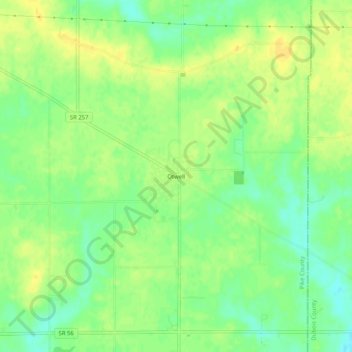
Name: Otwell topographic map, elevation, terrain.

Location: Otwell, Pike County, Indiana, 47564, United States (38.43477 -87.11223 38.47477 -87.07223)

Average elevation: 150 m

Minimum elevation: 137 m

Maximum elevation: 159 m

Other topographic maps

Click on a map to view its topography, its elevation and its terrain.

Petersburg

United States > Indiana > Pike County

Average elevation: 144 m

Winslow

United States > Indiana > Pike County

Average elevation: 138 m

Gear up for your next adventure:

🧭Orienteering Kit - Tools for map reading and navigation in the wild
🥾Hiking Leggings - Comfortable leggings for outdoor activities
🧴Sunscreen SPF - Broad-spectrum sunscreen for outdoor activities
🔥Camping Stove - Portable stoves to cook outdoors with ease
💧Collapsible Water Bottle - Space-saving water bottle for outdoor activities

As an Amazon Associate, this site earns from qualifying purchases at no extra cost to you.