Geolocate

Smithville topographic map

Click on the map to display elevation.

About this map

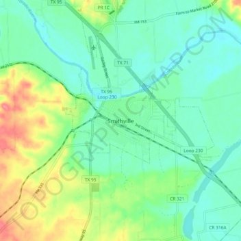
Name: Smithville topographic map, elevation, terrain.

Location: Smithville, Bastrop County, Texas, 78957, United States (29.96563 -97.19591 30.04563 -97.11591)

Average elevation: 107 m

Minimum elevation: 84 m

Maximum elevation: 161 m

Gear up for your next adventure:

🧢Outdoor Visor - Breathable visor for sunny hikes
🧼Travel Hand Sanitizer - Keep hands clean when water is scarce
💡LED Camping Lantern - Illuminate your campsite with long-lasting lanterns
💡LED Headlamp - Hands-free illumination for night hiking and camping
🥾Trekking Boots - Durable boots for long-distance trekking

As an Amazon Associate, this site earns from qualifying purchases at no extra cost to you.