Geolocate

Bentung topographic map

Click on the map to display elevation.

About this map

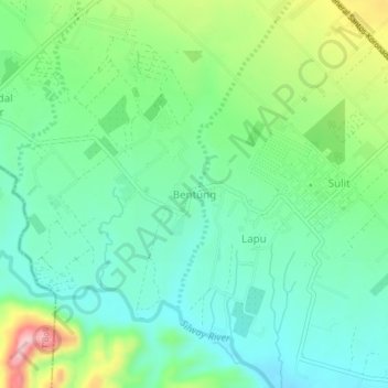
Name: Bentung topographic map, elevation, terrain.

Location: Bentung, Polomolok, South Cotabato, Soccsksargen, Philippines (6.21496 124.98879 6.25496 125.02879)

Average elevation: 335 m

Minimum elevation: 272 m

Maximum elevation: 483 m

Other topographic maps

Click on a map to view its topography, its elevation and its terrain.

Silway River

Philippines > South Cotabato > Polomolok

Average elevation: 257 m

Gear up for your next adventure:

🧢Beanie Hat - Keep your head warm in cold weather
🪜Heavy Duty Carabiners - Multi-use clips for securing gear to your backpack
Camping Tent - Weather-resistant tents suitable for 2 to 6 people
🛶Kayak Dry Bag - Waterproof storage for kayaking adventures
🥾Light Trekking Boots - Supportive boots for multi-day treks

As an Amazon Associate, this site earns from qualifying purchases at no extra cost to you.