
Thank you for supporting this site ❤️
Make a donation
Make a donation
Gear up for your next adventure:
As an Amazon Associate, this site earns from qualifying purchases at no extra cost to you.
Dhakla topographic map
Click on the map to display elevation.
Thank you for supporting this site ❤️
Make a donation
Make a donation
Gear up for your next adventure:
As an Amazon Associate, this site earns from qualifying purchases at no extra cost to you.
About this map
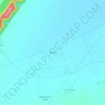
Name: Dhakla topographic map, elevation, terrain.
Location: Dhakla, Bansur Tehsil, Alwar District, Rajasthan, Inde (27.71493 76.30631 27.75493 76.34631)
Average elevation: 342 m
Minimum elevation: 328 m
Maximum elevation: 500 m
Thank you for supporting this site ❤️
Make a donation
Make a donation
Gear up for your next adventure:
As an Amazon Associate, this site earns from qualifying purchases at no extra cost to you.