
Thank you for supporting this site ❤️
Make a donation
Make a donation
Gear up for your next adventure:
As an Amazon Associate, this site earns from qualifying purchases at no extra cost to you.
Nudpud topographic map
Click on the map to display elevation.
Thank you for supporting this site ❤️
Make a donation
Make a donation
Gear up for your next adventure:
As an Amazon Associate, this site earns from qualifying purchases at no extra cost to you.
About this map
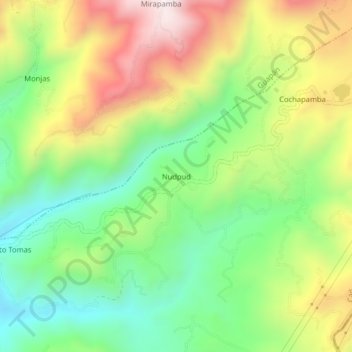
Name: Nudpud topographic map, elevation, terrain.
Location: Nudpud, Azogues, Cañar, Ecuador (-2.69386 -78.82382 -2.65386 -78.78382)
Average elevation: 3,093 m
Minimum elevation: 2,795 m
Maximum elevation: 3,511 m
Thank you for supporting this site ❤️
Make a donation
Make a donation
Gear up for your next adventure:
As an Amazon Associate, this site earns from qualifying purchases at no extra cost to you.