Geolocate

Las Tunas topographic map

Click on the map to display elevation.

About this map

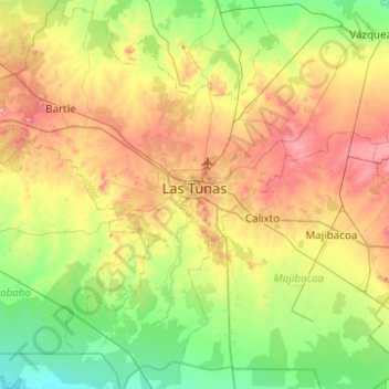
Name: Las Tunas topographic map, elevation, terrain.

Location: Las Tunas, Cuba (20.71839 -77.30163 21.18028 -76.83686)

Average elevation: 65 m

Minimum elevation: 6 m

Maximum elevation: 164 m

Gear up for your next adventure:

🦯Trekking Poles - Reduced impact on joints for steep topographic climbs
🗺️Topographic Maps - Detailed maps to explore trails, mountains, and wilderness areas
🪜Heavy Duty Carabiners - Multi-use clips for securing gear to your backpack
🚑Survival Whistle - Signal for help across long distances in mountains
🥾Mountain Hiking Shoes - Shoes with superior grip for mountainous terrain

As an Amazon Associate, this site earns from qualifying purchases at no extra cost to you.