Geolocate

Perrelos topographic map

Click on the map to display elevation.

About this map

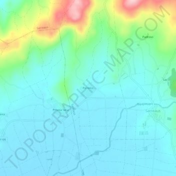
Name: Perrelos topographic map, elevation, terrain.

Location: Perrelos, Sarreaus, A Limia, Ourense, Galicia, 32631, Spain (42.07330 -7.64368 42.11330 -7.60368)

Average elevation: 673 m

Minimum elevation: 625 m

Maximum elevation: 855 m

Gear up for your next adventure:

🥾Hiking Gaiters - Protect legs and shoes from mud, snow, and debris
🥾Hiking Shoes - Durable and comfortable shoes for trail hiking
🌬️Windproof Camp Stove - Efficient cooking even on exposed mountain peaks
🧴Waterproofing Spray - Restore the DWR coating on jackets and tents
💡LED Headlamp - Hands-free illumination for night hiking and camping

As an Amazon Associate, this site earns from qualifying purchases at no extra cost to you.